
"Heavy" rain showers to hit Portsmouth area amid flood warnings and miserably wet week - hour by hour forecast

Persistently wet weather is set to continue today with the Met Office warning of “heavy showers”.
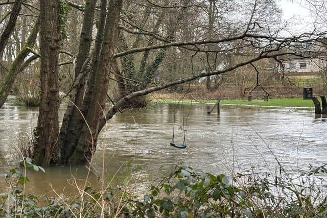
Consistent rain has fallen over the Portsmouth area this week, with several paths, roads, and open land being flooded. A yellow weather warning is currently in place until 9pm (February 6).
The Met Office said the downpours “are likely to cause minor surface water flooding and disruption in places”. They added: “An area of rain, heavy at times, will move northwards during Thursday morning.

“A brief drier and brighter spell may follow, but this likely to be short lived with heavy, slow moving showers through the afternoon, merging into longer spells of rain through the evening, overnight and through much of Friday.
“Through this event, 20-30mm is likely for many places, with some higher ground areas receiving in excess of 50mm. Given the widely saturated ground conditions, some surface water flooding is probable, with difficult driving conditions from spray, flowing water or flooded roads in particular.”
The forecast added that public transport may be delayed as a result of the conditions. The warning covers Portsmouth, Gosport, Havant, Fareham, Waterlooville, Hayling Island, and much of the south coast of England. It stretches westward as far as Cornwall.
Flood warnings
Residents on Hayling Island have been urged to avoid the seafront, with a flood warning currently in place. It said: “The shingle beach at Eastoke Corner has been impacted by high energy waves. Water could push further up the beach than normal. Property at Eastoke corner, near the nature reserve, and Southwood Road may flood.
“Overtopping of splash walls along the beach front may flood gardens. Beach huts at West Beach, near the Inn on the beach may be affected. We are closely monitoring the situation. Activate any flood protection products you may have . Avoid South Hayling seafront. Shingle can be thrown by wind and waves.”
Warnings are also in place along the River Meon in Titchfield and Wickham. “River levels will rise, and there could be further flooding,” the alert said on the government website.
“While groundwater and river levels are currently so high, any intense rainfall events are now likely to cause surface water flooding in Titchfield High Street. Ensure any flood protection products you have are activated. River levels will remain higher than normal, and flood risk will continue into the weekend.
“Flooding could further affect the Millennium Meadows, and commercial and industrial property downstream of the main A334 Fareham Road could flood. Access to property in Bridge Street could be affected.”
Hour by hour Met Office forecast
9am - light rain - 70 per cent chance of rain - 9C
10am - light rain - 90 per cent chance of rain - 10C
11am - light showers - 70 per cent chance of rain - 10C
12pm - light showers - 70 per cent chance of rain - 10C
1pm - overcast - 50 per cent chance of rain - 11C
2pm - overcast - 50 per cent chance of rain - 11C
3pm - light showers - 60 per cent chance of rain - 11C
4pm - light showers - 60 per cent chance of rain - 10C
5pm - partly cloudy - 40 per cent chance of rain - 10C
6pm - partly cloudy - 20 per cent chance of rain - 10C
7pm - partly cloudy - 10 per cent chance of rain - 10C
8pm - partly cloudy - 30 per cent chance of rain - 9C
9pm - partly cloudy - 20 per cent chance of rain - 9C
10pm - partly cloudy - 20 per cent chance of rain - 9C
11pm - partly cloudy - 20 per cent chance of rain - 9C