
All 60 neighbourhoods which are almost Covid free in Portsmouth, Gosport, Fareham, Havant, Waterlooville and Hayling Island
The latest government figures have revealed the areas in the Portsmouth area where cases of coronavirus have been suppressed.
On the Covid dashboard it describes this as being an area having fewer than three cases over a seven-day period.
The figures cover the seven days to April 8 and break down to postcode areas.
It comes as the lockdown measures were eased again on Monday – with non-essential retail allowed to open as well as hair salons, barbers and outdoor hospitality.
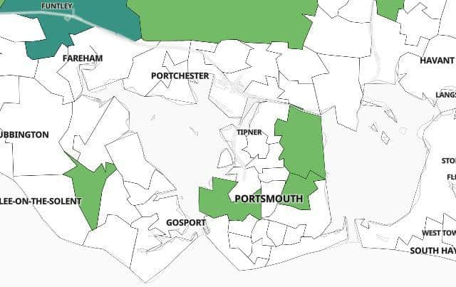

We have included all the neighbourhoods which are classed as suppressed on the government’s website.
You can see the list below – it is broken down by area.
Portsmouth
- Alexandra Park
- Cosham North
- Cosham South
- Drayton and Farlington
- Eastney
- Fratton Kingston
- Fratton North
- Hilsea
- Landport
- Milton
- North End East
- North End West and Whale Island
- Old Portsmouth and Southsea Common
- Paulsgrove East
- Paulsgrove West and Port Solent
- Somers Town
- Southsea Fawcett Road
- Southsea Haslemere Road
- Southsea Prince Albert Road
- Southsea Waverley Road
- Southsea West
- Wymering
Fareham
- Fareham Fort
- Fareham Town and Cams Hill
- Fareham West
- Hill Head
- Locks Heath
- Park Gate and Segensworth
- Portchester North West
- Portchester South East
- Stubbington
- Titchfield and Titchfield Common
- Warsash
Gosport
- Alverstoke and Privett
- Bridgemary North
- Bridgemary South
- Brockhurst
- Clayhall and Anglesey
- Elson
- Gosport Town
- Lee-on-the-Solent
- Priddy's Hard and Brockhurst East
Havant and Waterloovile
- Bedhampton
- Central Havant and Langstone
- Clanfield and Finchdean
- Cowplain West
- Emsworth
- Hayling Eastoke
- Hayling West and North
- Horndean North
- Horndean South and Rowlands Castle
- Leigh Park
- Purbrook and Widley
- South Hayling
- Stockheath Common
- Waterlooville Central
- Waterlooville East
- Waterlooville North East
- Waterlooville North West
- West Leigh